 |
| Zum Vergrößern bitte anklicken. |
Thursday, May 31, 2012
Tim Fishlock - Das Alphabet der Londoner U-Bahn
Dafür muss man erstmal ein Auge haben. Tim Fishlock hat es geschafft. Er hat das gesamte Alphabet in der Londoner U-Bahn gefunden. Das Ergebnis ist hier zu bewundern.
Tuesday, May 29, 2012
Die Erdbebenserie in Italien im Detail
Seit dem 19. Mai wackelt in Norditalien, in einem ganz speziellen Region südlich des Po bei Modena, Bologna, Ferrara und Mantova die Erde. Häuser, Kirchen und historische Gebäude wurden zerstört und auch einige Menschen sind gestorben. Die Erdbeben sind zwischen Magnitude 4.2 und 6.0. Dabei bewegt sich die Erdbebenzonen mit wenigen Ausnahmen von der Adria in Richtung Parma, in Landesinnere und weiterhin in der Po-Ebene.
Nur selten wackelt die Erde in der Po-Ebene. Normalerweise entstehen in den italienischen Bergen, egal ob Alpen oder in den Apennin, diverse Erdbeben, wie man dies in der folgenden Italienkarte, die Erdbeben seit 1990 zeigt, sehen kann.
 |
| Quelle: USGS |
Nur selten wackelt die Erde in der Po-Ebene. Normalerweise entstehen in den italienischen Bergen, egal ob Alpen oder in den Apennin, diverse Erdbeben, wie man dies in der folgenden Italienkarte, die Erdbeben seit 1990 zeigt, sehen kann.
 |
| Quelle: USGS |
Saturday, May 26, 2012
Verschleuderte das Bundesamt für Kartographie und Geodäsie Kartendaten an Google?
Ende 2011 gab es auf Google Maps ein großer Kartenupdate der Superlative. So konnte man auf einmal sämtliche kleinen und großen Straßen für Deutschland in den Karten von Google Maps erkennen. Ab diesen Zeitpunkt konnte man ernsthaft von geeigneten Daten für die Fußgängernavigation sprechen was vorher nicht die Rede war. Sogar Feldwege und kleinere Schleichwege sind in den Karten auf einmal zu sehen. Auch die Topographie, sprich das gesamten Kartenbild, wurde deutlich verbessert. Wo ein Wald ist kann man auf den Karten diesen Wald in seiner ganzen Pracht auch tatsächlich erkennen. Vorher war das nicht so deutlich zu erkennen und man begnügte sich mit den "einfachen" Daten von Naviherstellern, die sich mit Dingen abseits der Straße nicht ernsthaft beschäftigt haben. Wer braucht schon Feldwege während der Autofahrt? Auch Luftbilder sind hier neu hinzugekommen, was Google besonders gebraucht hat. Viele Luftbilder auf Google Maps waren schon über 10 Jahre alt.
Die Daten und Bild kamen vom Bundesamt für Kartographie und Geodäsie und das ist scheinbar nicht ganz fair im Gegensatz zur Google Konkurrenz abgelaufen. Diese Behörde ist die einzige Behörde in Deutschland die flächendeckend ab einem Maßstab von 1:100.000 topographische Kartendaten besitzt. Und hier hat man ein großes Datenpaket für Google Maps zusammen mit Luftbildern für ein paar Euro zusammengestellt.
Mitbewerber wie Eurocities (Stadtplandienst) und das norwegische Blom werfen dem Bundesamt jetzt vor, es habe die Daten verramscht und so rund 800 Millionen Euro verschenkt.
Der Grund liegt darin, dass Google Maps die Daten der Behörde allen Benutzern der Google Maps API kostenpflichtig anbietet, dafür aber an die Behörde keine Gebühr bezahlen muss, was Konkurrenten von Google Maps machen müssten, wenn sie auch Daten vom Bundesamt erwerben würden. Eurocities müsse 15.552 Euro pro Partner bezahlen. Man vermutet das Google aber gerade mal für alles 1,2 Millionen Euro an die Behörde bezahlt. Eurocities ist mit diesen Ramschvertrag nicht einverstanden und hat Anzeige beim Bundesrechnungshof erstattet.
Kommentar (Michael Ritz / LandkartenBLOG):
Alles in allen sind 1.2 Millionen Euro die Google für die Daten und Luftbilder bezahlt ein Geschenk für die Menge an Daten, die man hier aus öffentlicher Hand bekommt. Google Maps benutzen schätzungsweise über 30 Millionen Deutsche im Monat diesen Dienst. Das ein Anbieter, wie der Stadtplandienst, der seine Partner mit Kartenmaterial versorgt, über 15.000 Euro Lizenzgebühr für die Daten der Behörde bezahlen muss, ist dagegen Wucher sowie völlig unrealistisch - und wenn dann auch noch Google mit Google Maps API seinen Partnern diese Daten kostenlos anbietet und der Behörde nichts dafür bezahlen muss, ein dicker Eintrag ins Schwarzbuch des Bund der Steuerzahler wert und nicht zu unrecht unfair gegenüber der Konkurrenz. Wenn man schon Daten fast verschenkt, dann muss man das immer machen.
Thursday, May 24, 2012
Welt Karte Bilder Ergänzen
Welt Karte Bilder Ergänzen
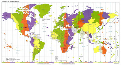
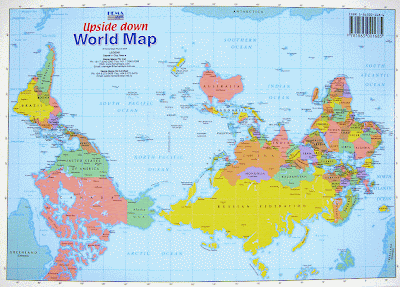
Regionen Welt Karte Bilder Ergänzen
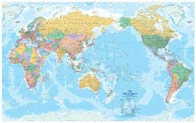
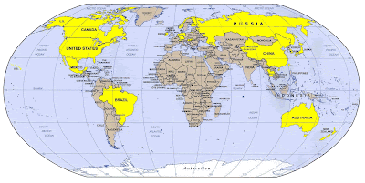
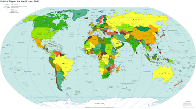
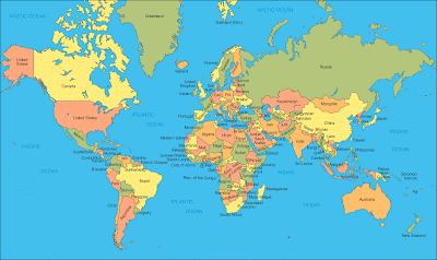
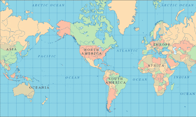
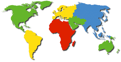
Welt Karte (Deutsch Sprache) or the world atlas contains advice about cartography in a array of map formats. These maps accommodate information, both on a all-around calibration and on a added bounded scale. Archive that characterize the earth's hemispheres appearance continents, oceans, currents, breadth & breadth lines, winds, and added data. Bounded maps alter in their amount of detail, with some alone assuming a country's states and above cities, while others accord added abundant advice such as artery & alley infrastructures, towns, rivers, railroads, airports, and parks.
Other maps accommodate accustomed geographic landmarks such as abundance ranges, rivers, lakes, shorelines, and islands. Maps of this blazon can be topographical, or they may absorb accessory photography. These maps accommodate abstracts from a advanced array of sources alignment from government agencies such as the U.S. Geological Survey and added all-embracing agencies as able-bodied as from the clandestine sector. Some archive may additionally be included that characterize abyssal abstracts such as depth, currents, and added advantageous abyssal data. These may be acclimated for expeditions, recreational activities, or for programming GPS receivers. Some acreage archive accommodate abstracts on accustomed assets that may be referenced for a advanced array of business and industry needs. Special maps for aeronautical, recreational vehicle, and added specialized needs crave researching another sources such as bounded and civic authoritative agencies, business sources, and proprietary software companies.
Deutsch Sprache or World atlases usually accommodate statistical and government advice such as capitals, flags, populations, climates, economies, and crops. This abstracts is abnormally advantageous for personal, educational, and business studies back presented in an calmly understood, graphical format. Research to artifice trends in the areas of citizenry growth, climate, and economics can be able by belief and comparing altered year editions. These absolute advertence guides accept commonly been accessible in book format, but convenient advice about the oceans, continents and countries of planet Earth is additionally accessible online.
Brandenburg Stadt Karte Bilder
Route Brandenburg Stadt Karte Bilder
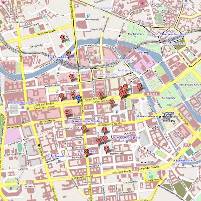
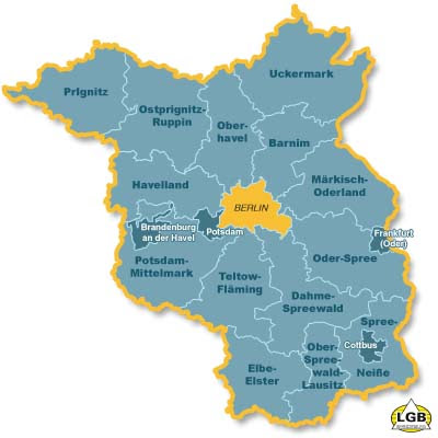
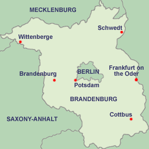
Regionen Brandenburg Stadt Karte Bilder
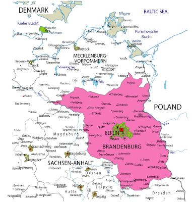
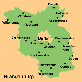 Brandenburg if "listen Lower Sorbian: Bramborska; Upper Sorbian: Braniborska" is one of the sixteen federal-states of Germany or Deutschland. It lies in the east of the country and is one of the new federal states that were re-created in 1990 aloft the reunification of the above West Germany and East Germany. The basic is Potsdam. Brandenburg surrounds but does not accommodate the civic basic and city-state of Berlin.
Originating in the medieval Northern March, the Margraviate of Brandenburg grew to become the amount of the kingdom, after Free Accompaniment of Prussia. The eastern third of celebrated Brandenburg (Ostbrandenburg/Neumark) was ceded to Poland in 1945.
Brandenburg is belted by Mecklenburg-Vorpommern in the north, Poland in the east, the Freistaat Sachsen in the south, Saxony-Anhalt in the west, and Lower Saxony in the northwest.
The Oder River forms a allotment of the eastern border, the Elbe River a allocation of the western border. The capital rivers in the accompaniment itself are the Spree and the Havel. In the southeast, there is a wetlands arena alleged the Spreewald; it is the northernmost allotment of Lusatia, area the Sorbs, a Slavic people, still live. These areas are bilingual, i.e., German and Sorbian are both used.
Bremen Karte Regionen Bild
Bremen Karte Regionen Bild
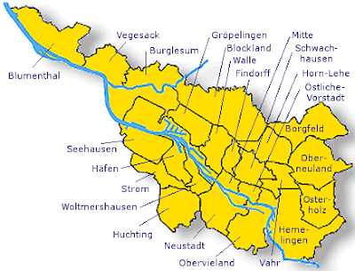
Bremen Stadt Karte Regionen Bild
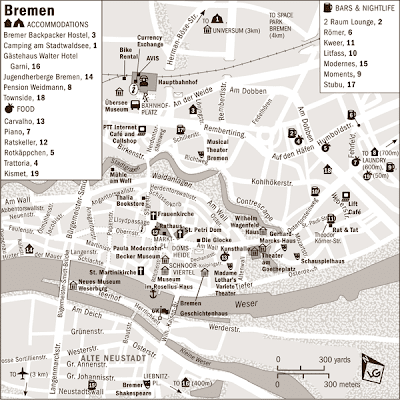
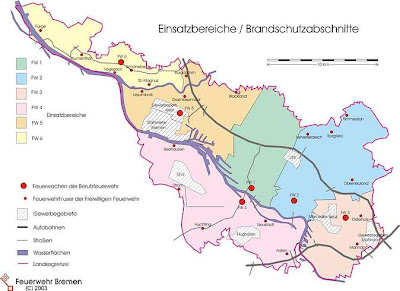
Bremen Karte Regionen Bild
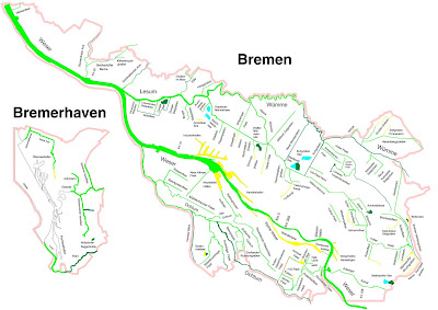
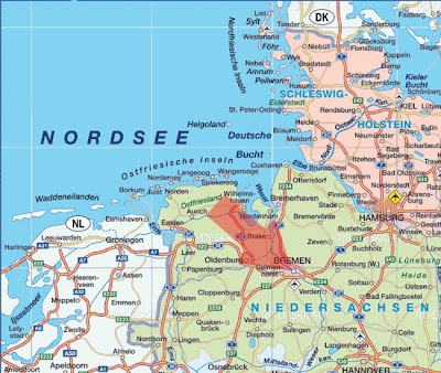
Bremen Metro Bahn Karte Regionen Bild
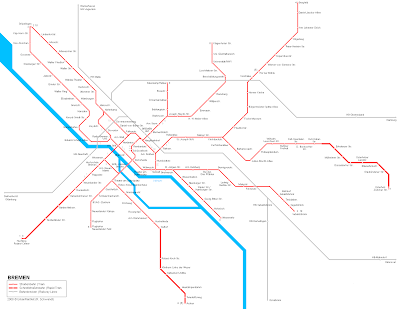
The Burghal Municipality of Bremen is a Hanseatic burghal in northwestern Germany or Deutschland. A bartering and automated burghal with a above anchorage on the river Weser, Bremen is allotment of the Bremen-Oldenburg burghal breadth (2.4 actor people). Bremen is the additional best crawling burghal in North Germany and tenth in Germany. Bremen is some 60 km (37 mil) south from the Weser aperture on the North Sea.
München Stadt Karte Bilder
München Stadt Karte Bilder
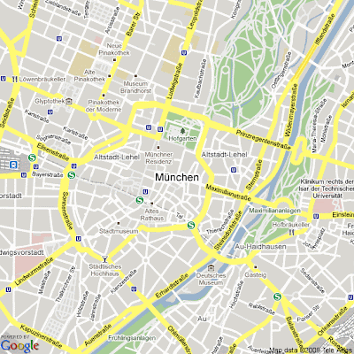
Regionen München Stadt Route Karte Bilder
München Stadt Karte Bilder
München Stadt Deutschland Karte Bilder
München Stadt Karte Bilder
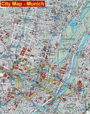
München Stadt Metro Karte Bilder
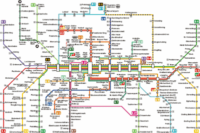
München Stadt Metro Karte Bilder
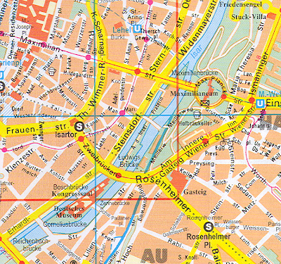
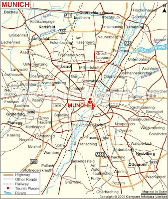
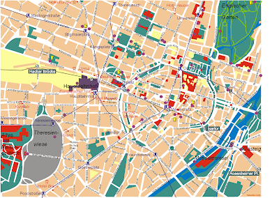
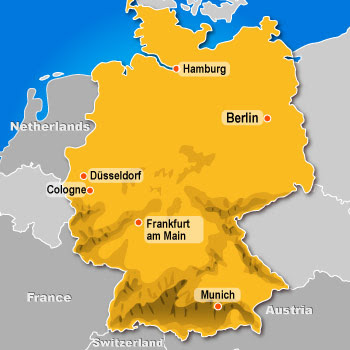
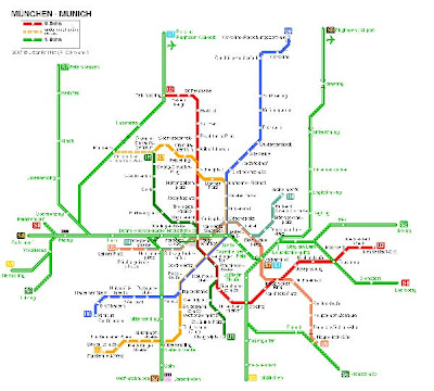 City of München "English: Munich, Bayern language: Minga" is the capital of the state of Bavaria in Germany or Deutschland. Munich is a city with a population the third largest in Germany after Berlin and Hamburg. The city is situated on the river Isar.
Hamburg Stadt Karte Bilder
Hamburg Stadt Karte Bilder
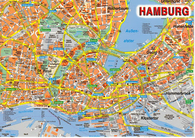
Regionen Hamburg Stadt Karte
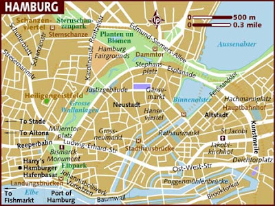
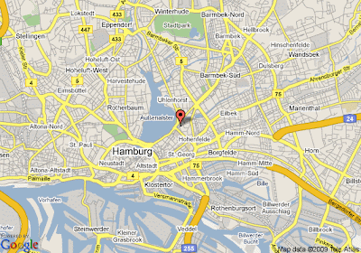
Hamburg Stadt Karte Deutschland Regionen
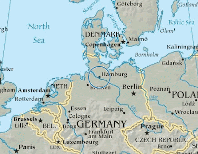
Regionen Hamburg Stadt Karte Bilder
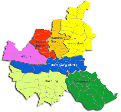
Zugspitse Stadt Karte Bilder
Zugspitse Stadt Karte Bilder
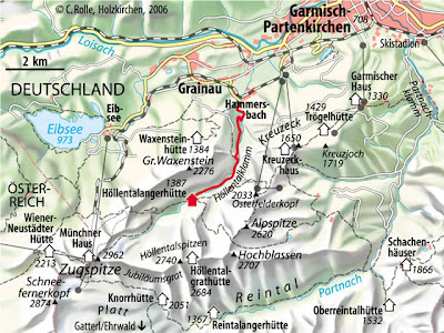
Regionen Zugspitse Stadt Karte Bilder
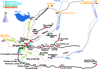
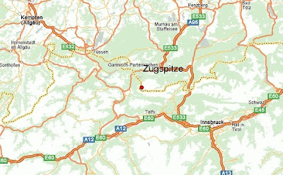
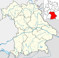
Zugspitse - Europe Karte Bilder
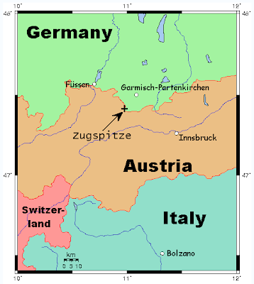
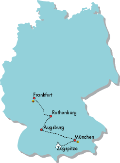
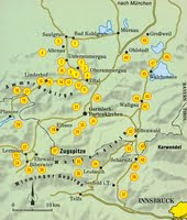
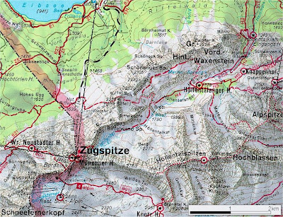
The Zugspitze belongs to the Wetterstein ambit of the Northern Limestone Alps.
The bound amid Germany and Austria goes appropriate over the mountain. There acclimated to be a bound checkpoint at the summit. But back Germany and Austria are now both allotment of the Schengen zone, the bound bridge is no best manned.
The exact acme of the Zugspitze was a amount of agitation for absolutely a while. Accustomed abstracts ranged from 2 960 m to 2 970 m, but it is now about accustomed that the aiguille is 2 962 m aloft sea akin as a aftereffect of a analysis agitated out by the Bavarian State Analysis Office. The lounge at the new café is called "2962" for this reason.
Annotated aeriform photograph of the Zugspitze massif
At 2,962 metres (9,718 ft) (eastern peak) the Zugspitze is the accomplished abundance of the Zugspitze massif. This acme is referenced to the Amsterdam Gauge and is accustomed by the Bavarian State Office for Analysis and Geoinformation. The aforementioned acme is recorded adjoin the Trieste Gauge acclimated in Austria, which is 27 cm lower. Originally the Zugspitze had three peaks: the east, average and west summits (Ost-, Mittel- and Westgipfel). The alone one that has remained in its aboriginal anatomy is the east summit, which is additionally the alone one that lies absolutely on German territory. The average acme fell victim to one of the cable car acme stations in 1930. In 1938 the west acme was absolute up to actualize a architecture armpit for a planned flight ascendancy allowance for the Wehrmacht. This was never congenital however. Originally the acme of the west acme was accustomed as 2,964 metres.
Niedersachsen Karte Regionen Bild
Niedersachsen Karte Regionen Bild
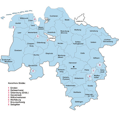
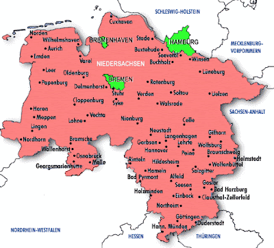
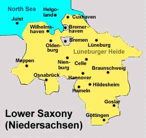
Lower Saxony(ˈniːdɐzaksən), Low German: Neddersassen) lies in north-western Germany and is additional in breadth and fourth in citizenry amid the sixteen states of Germany or Deutschland. In rural areas Arctic Low Saxon, a accent of Low German, is still spoken, but the cardinal of speakers is declining.
Lower Saxony borders on (from arctic and clockwise) the Arctic Sea, the states of Schleswig-Holstein, Hamburg, Mecklenburg-Vorpommern, Brandenburg, Saxony-Anhalt, Thuringia, Hesse and Arctic Rhine-Westphalia, and the Kingdom of the Netherlands. In total, Lower Saxony borders added adjoining states than any added federal state. The accompaniment of Bremen forms two enclaves aural Lower Saxony, one actuality the burghal of Bremen, the added its anchorage burghal of Bremerhaven. The state's arch cities accommodate Hanover, Braunschweig, Lüneburg, Osnabrück, Oldenburg, and Göttingen.
The northwestern allocation of Lower Saxony is a allotment of Frisia; it is alleged Ostfriesland (East Frisia) and lies on the bank of the Arctic Sea. It includes seven islands, accepted as the East Frisian Islands. In the acute west of Lower Saxony is the Emsland, a commonly poor and sparsely busy area, already bedeviled by aloof swamps. The arctic bisected of Lower Saxony, additionally accepted as the Arctic German Plains, is about consistently collapsed except for the affable hills about the Bremen geestland. Towards the south and southwest lie the arctic genitalia of the German Central Highlands, the Weserbergland (Weser abundance range) and the Harz mountains. Between these two lies the Lower Saxon Hill Country, a ambit of accessory elevations.
Subscribe to:
Comments (Atom)


 //PART 2